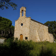

Introduction
Where the sea and land meet.
This charming route along by the sea takes us to Sant Pol beach by the Camino de Ronda (GR-92), through a very-well preserved coastal pine forest.
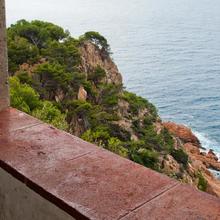
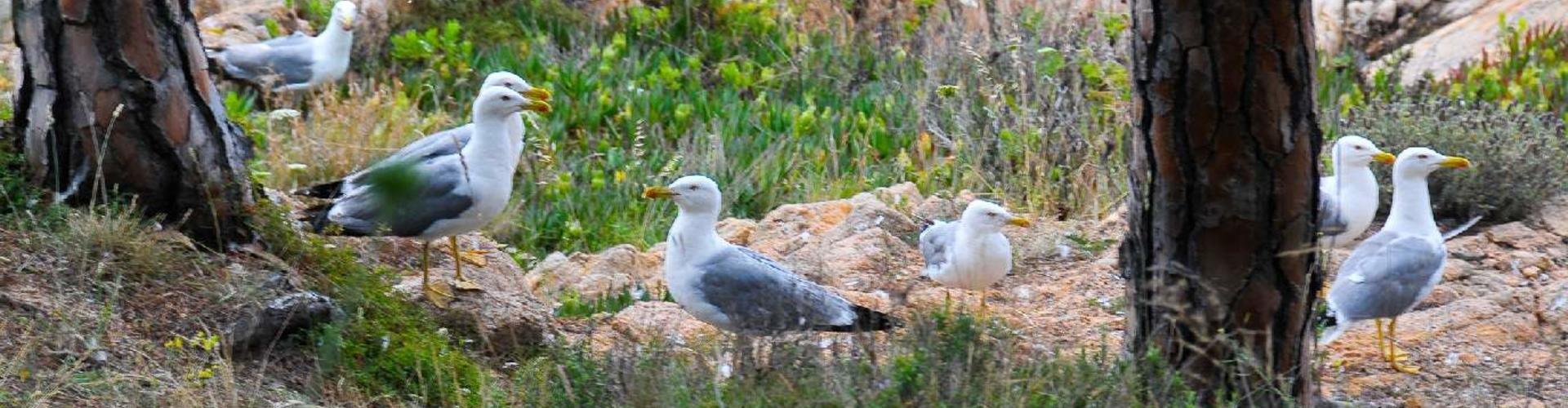
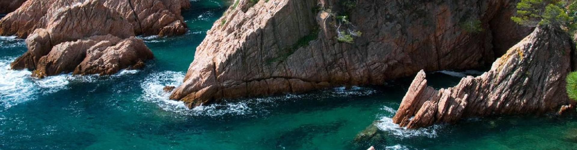
This is the essence of the Costa Brava, where the Ardenya Cadiretes massif abruptly meets the sea in the form of cliffs and breaks into bits forming bold reefs. The mountain streams and charming little coves sheltered by rocks and holm oaks are like something out of a dream.
We recommend the Local Natura App to do this route. Download it for free here:
Apple store Google Play-
TypologyLinear
-
DifficultyEasy
-
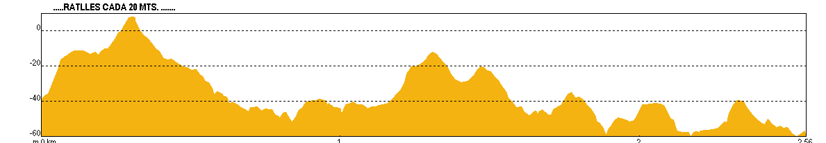
Duration1 hour 20 minutes
-
Slope114.00 meters
-
Distance2.40 km
-
ThemeFlora and faunaLandscapingGeologia
-
ActivityBy foot
-
Rating
Slope graph
Description
Where the sea and land meet.
We're using an ancient road used to monitor the coastal towns in the 19th and 20th Centuries, today a walking route and access path to reach the coves and contemplate the beautiful coastline. (GR-92)
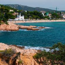
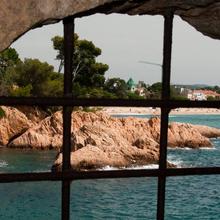
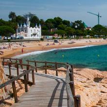
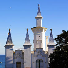
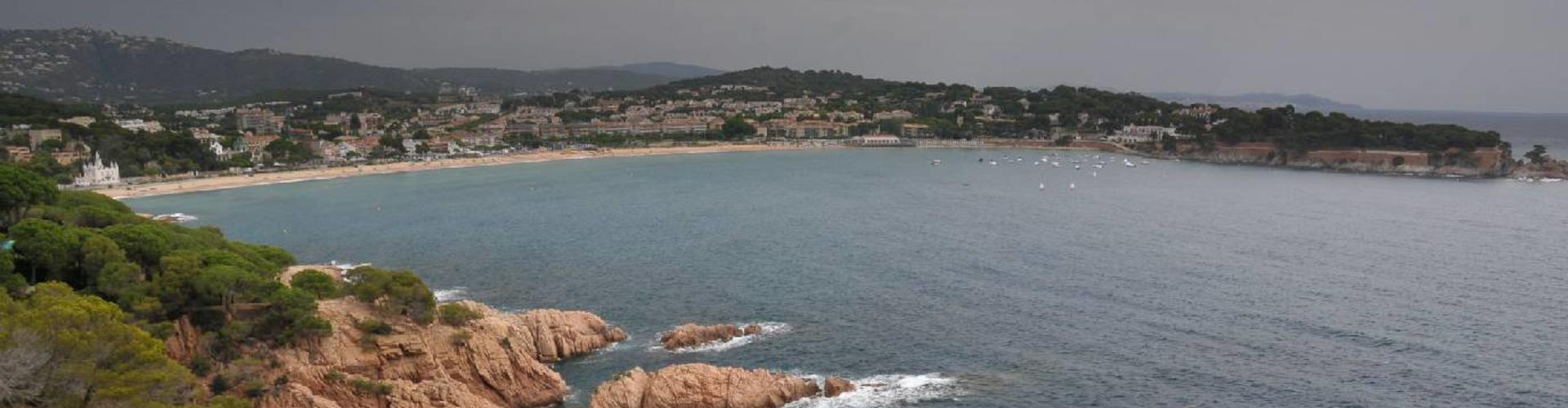
We start at the sea port where we will have the first and only view of Sant Feliu with the Fortim, later the Lifeboat House (1897) and current annex to the History Museum. Next, along a well-maintained path with stairs going up and down, we pass various lookout points (Peixateres (fishmongers) and Triadores (Cork Sorters)) between the cliffs and the urbanisation.
We arrive at an outcrop, where Cala Molí is found. Here there is the possibility of doing a well-equipped via ferrata around the cliffs that surround the cove.
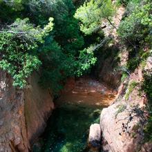
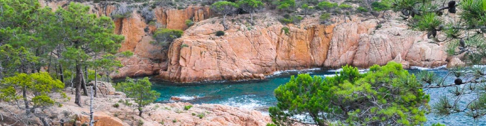
In a flash, the path becomes forested, entering the sector under the protection of the Volta de l'Ametller Area of Natural Interest.
We go through a pretty coastal stone pine forest with undergrowth of holm-oak wood in the streams that emerge in the dryest parts. Exceptionally, close to the charming Ametller cove, we find strawberry myrtle and rock-rose.
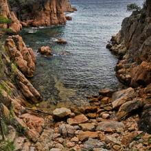
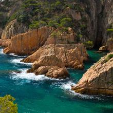
At the edge of the forest, the granite rocks come close to the water in the form of cliffs and rocky outcrops. At the water's edge the cliffs overhang the sea. The crystal clear, shallow waters allow glimpses of a hypnotising underwater landscape.
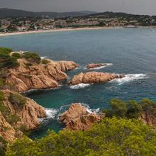
We reach the highest point, the Les Mestresses lookout point, next to the Cap de Mort Point. The views give you an idea of the shape of the coastline. Cliffs, reefs and caves create postcard images. We can see Sant Pol beach. It seems like we're already there but we're actually halfway.
We go down and approach the water every now and then to get different perspectives of the previous views. We go through another urbanised sector, with the path newly repaired between the houses and the coastline, but no less pretty for this.
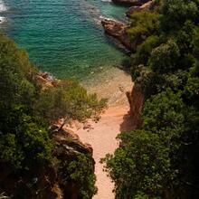
A line of small coves, narrow and slotted in between the rocks and holm oaks like Dels Mussols, Del Peix, Des Cran and Del Maset, amongst others. The coves entice us to stop and have a dip, practice snorkelling or enjoy their tranquillity and overwhelming beauty.
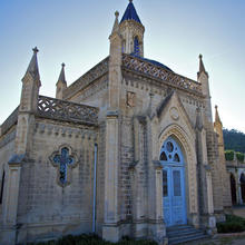
Without realising it, after another lookout point, we go through the tunnel of such in which the trees are natural bonsai trees. We reach the Sant Pol beach. Now, the Casa Estrada stimulates the senses even more after so much "wild" beauty.
Tips
TRAÇAT
- La ruta es linial, per tant, cal reservar temps i forces per la tornada.!!
- El camí és sempre evident, segueix el GR 92 (senyals blanques i vermelles). Als trams de bosc, seguirem uns pals (50 cms) de fusta amb el cap metàlic.
- El camí segueix sempre la linia de costa, uns metres terres endins, però podeu anar fent petites incursions a tocar d’aigua i tornar de nou al camí.
- Hi ha trams d’escales, tant de pujada com de baixada, força drets.
- El sector a ‘‘Cala Ametller’’ està declarat com a zona protegida d’especial interes. PEIN.
AIGUA
- No hi ha cap font.
PRECAUCIONS
- Vigileu els més petits. NO deixeu que s’apropin sols a la vora dels penyassegats. Es poden despistar i caure a l’aigua en molts llocs.
- S’ha de tenir el màxim de respecte al mar i més quan no hi ha platja i les roques poden dificultar l’accés.
- Les arrels dels pins són molt superficials i ens poden fer relliscar o ensopegar.
- Si hi ha mala mar, no us apropeu a les roques.
METEO
- Evitar els dies de temporal de mar si aneu amb nens.
- Els dies de vent, la primera linia de costa és molesta.
- Protegiu-vos del sol a l’estiu.
TERRENY
- Camí accidentat a les baixades i pujades del tram de Cala Ametller.
- La resta, camí arreglat amb trams d’escales exigents.
MATERIAL
- Protecció solar. Protecció pel vent.
- Màquina fotogràfica.
- Allò que considereu necessari si voleu aprofitar les cales que anireu trobant. (és un bon lloc per fer ‘‘snorkel’’). Penseu que el temps del trajecte s’allargarà molt.
- Si voleu fer la via ferrada de cala Moli, he de dur material especial per aquesta activitat.
ALTRES EQUIPAMENTS
- Qualsevol cala és un bon lloc per practicar ‘‘snorkel’’ o llegir un llibre.
- Podeu fer la Via Ferrada de Cala Molí amb 500 mts de recorregut equipat de dificultat mitjana. Hi ha una empresa d’aventura que lloga el material imprescindible i pot fer el guiatge.
- Plafons interpretatius al PEIN de Cala Ametller.
- Els miradors tenen plafons amb imatges interpretatives, algunes però, trencades.