Introduction
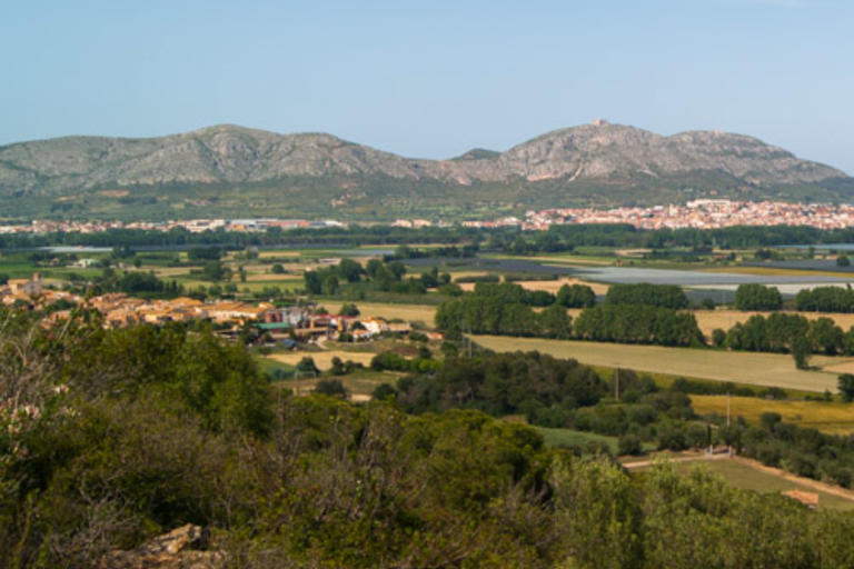
The Puig de la Font Pasquala, with a modest height of 92 metres, offers unique views of the Baix Ter which are worth the climb. It is a very good place to study a little the geography of the surrounding area.
The plain of the Baix Ter opens up before you with the Gola del Ter, which is where the river Ter has flowed into the sea since the fifteenth century, when the Count of Empúries diverted the river’s course. Until then it had flowed into the sea at l’Escala. History says that the Count of Empúries and the King were enemies and during one of their arguments, the count decided to divert the river so it would flood the Torroella are, which was controlled by the King.
At the north of the plain is the Montgí massif, which from a geological viewpoint is the start of the Pyrenees. To the south, are the Begur mountains which are very different geologically.