Introduction
Hermitage, castle and good views
This circular itinerary takes you on a trip around the most important points in the central part of the Montgrí Massif. Starting from the Warden’s Lodge, the outbound leg leads to the hermitage of Santa Caterina and climbs up to the castle of Montgrí. It then returns to the starting point, passing through the Montplà. For much of the route, you can enjoy panoramic views of the Alt Empordà, the gulf of Roses, Cap de Creus, the Empordanet and the Baix Ter, Torroella de Montgrí, the Medes Islands and the Gavarres.
We recommend the Local Natura App to do this route. Download it for free here:
Apple store Google Play


-
TypologyAnti-clockwise circular
-
DifficultyMedian
-
Duration2 hours
-
Slope350.00 meters
-
Distance5.00 km
-
ThemeFlora and faunaArchitecture and environmentLandscaping
-
ActivityBy foot
-
Rating
Slope graph

Description
Hermitage, castle and good views
This circular itinerary is not very long but is fairly demanding because of the constant climbing and descending and the steep paths you have to follow in some stretches. It enables you to visit the main heritage points of interest in the central part of the Montgrí Massif and for much of the route you can enjoy different panoramas of the surrounding area: Canigó, Alberes, the Alt Empordà, the gulf of Roses, Cap de Creus, the Empordanet and the Baix Ter, Torroella de Montgrí, the Medes Islands, the Gavarres…
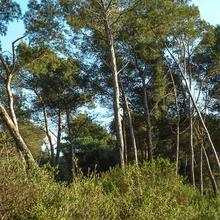
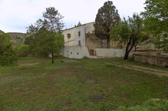
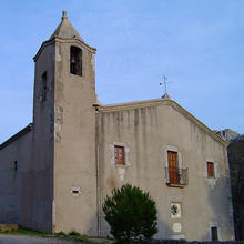
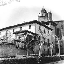
Starting from the Warden’s Lodge, which has easy parking and a picnic area with tables and benches, the trail goes through the middle of a small open pine grove with a gentle climb before descending again towards the most interesting part of the valley of Santa Caterina, where you will find the solitary hermitage of the same name, a place which has provided literary inspiration and is of great popular devotion in the surrounding area.
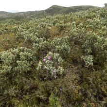
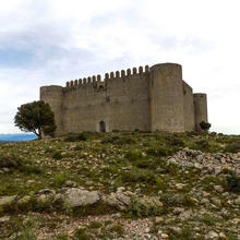
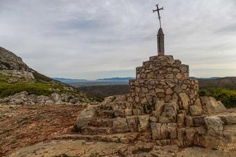
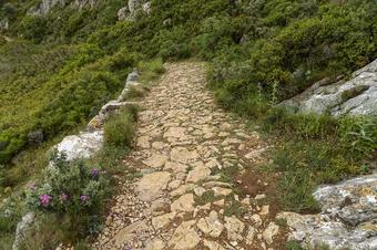
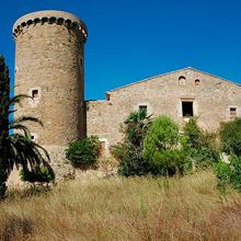
The route climbs steeply again through the garrigue and, taking a break at the Coll de la Creu, you climb all the way to the vantage point of the castle of Montgrí, a historical emblem of the mountain. Up here you can enjoy great views of al of the surrounding area.
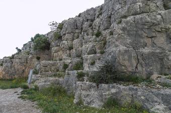
Now it is time for an intrepid descent on narrow paths with poor footing to the Coll d’en Garrigars before you regain the lost height by ascending to the Montplà, a large high plain or plateau from where it is also worth looking at the great panoramic views on offer.
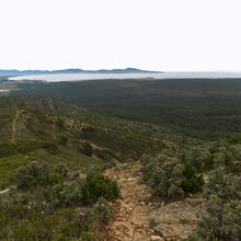
To finish, you complete the circle by descending and doing the final flanking of the north and west sides of the Montplà, where from some points you can see the great wooded inland dune of the Montgrí, finally returning to your starting point after a short while.
Tips
ROUTE
- This route is fairly short but quite demanding because of the continuous climbs that have to be overcome. For people who are used to walking, this will be no problem, but it is a certain effort to take into account for people who are not used to it or for young children.
- The climbs of the Coll de la Creu to the castle of Montgrí and of the Coll d’en Garrigars to the Montplà are short but demanding.
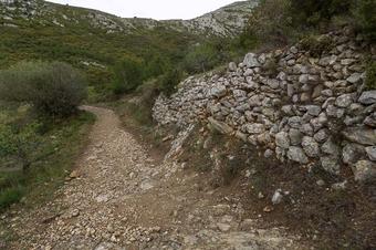
- Almost all of the route is on rocky paths and trails, with a lot of loose rock which adds a certain degree of difficulty owing to the high risk of slipping, as the rocks can easily shift under your footsteps.
WATER
- There are no drinking water points anywhere on the route. Take well filled bottles!
PRECAUTIONS
- Take care with children in certain parts of the route where there is a risk of falling on the steepest sloping faces.
- Take care on descents as the steep, rocky terrain makes it easy to slip or twist an ankle, especially if it has rained and the rock is wet.
WEATHER
- Owing to the type of low vegetation that predominates in the area – garrigue – the route offers virtually no shade. It is also advisable to avoid the midsummer heat. In summer, it is best to go in the early morning or in the evening.
- It is important to be very careful or leave the route if it is windy or the tramuntana is forecast to become stronger. This is a very strong wind and in the most exposed parts of the peaks you will undoubtedly feel all of its force. As well as being very unpleasant, it is dangerous as it can make you lose your balance in exposed sections.
- It is best to wear clothing that protects you for the places exposed to the wind, even if it seems like it is not blowing too strongly. On the top of peaks and ridges things could be very different.
- Consider wearing sun cream, all through the year. You are exposed to the sun in all of the route.
TERRAIN
- The terrain is rocky, sharp and, in some places, slippery. It is very important to wear suitable footwear, that is, walking boots with a high top and thick grippy soles.
- Some downhill sections are a little difficult.
EQUIPMENT
- A hat and sunglasses are recommended in the summer.
- Binoculars are always worth taking if you like watching nature in detail.
- Hiking poles are always helpful, both on the climbs and on the descents.
- If you enjoy photographing panoramic views, take a camera.
OTHER FACILITIES
- At the warden’s lodge, the start and end point of the route, there is a picnic area and parking.
- There are information boards in the main points of heritage interest: the hermitage of Santa Caterina, castle of Montgrí, etc.


