Introduction
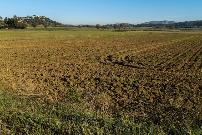
The flat area to the left of the trail, between Llabià and Ullastret approximately used to be a more or less permanent lake, fed by the waters of the river Daró.
It was, hydrologically speaking, an area where overflowing water would accumulate in periods of heavy rain, naturally regulating the river’s floods, and which connected to the sea with small lakes and marshes in the area of the Baix Ter and Pals.
The lake had some islands, like the Illa d’en Reixac, which you will pass through later, with traces of a small Iberian settlement.
The lake was eventually drained between the middle and end of the nineteenth century using a system of ditches and channels, converting the old lake area into one with productive crops and a healthier environment free from diseases like malaria. However, even today, in some years there are episodes of flooding which partially bring it back to life for days or weeks.