Introduction
Granite sculptures itinerary. Towers, boulders, dolmens and caves.
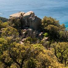
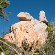
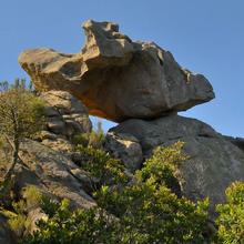
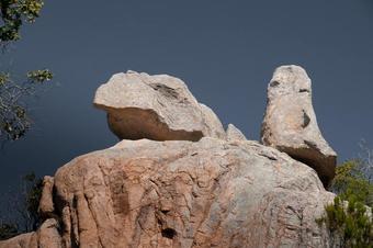
A comprehensive, pretty itinerary which takes us deep into the coastal mountains amongst cork oak forests. We discover unique granite rock formations along the way which, apart from their geological value, add great aesthetic value in the way they combine with the vegetation.
We recommend the Local Natura App to do this route. Download it for free here:
Apple store Google Play

-
TypologyTime Circular
-
DifficultyMedian
-
Duration3 hours 45 minutes
-
Slope415.00 meters
-
Distance10.30 km
-
ThemeFlora and faunaGeologiaLandscaping
-
ActivityBy foot
-
Rating
Slope graph

Description
Granite sculptures itinerary. Towers, boulders, dolmens and caves.
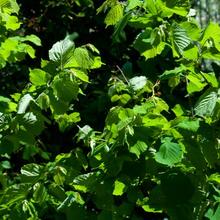
We come out of the same side of the village, through the Mascanada area and the Les Comes stream which we'll soon leave behind to climb up between maritime pines, stone pines and cork oaks in the direction of the Pico de Can Toni. The remnants of the forest gradually alter and give way to the streams with hazelnut trees and ferns which form a contrast with the dryness of the surrounding brush.
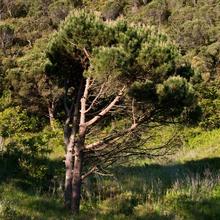
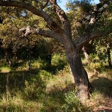
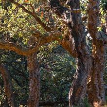
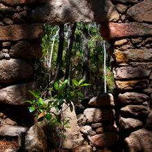
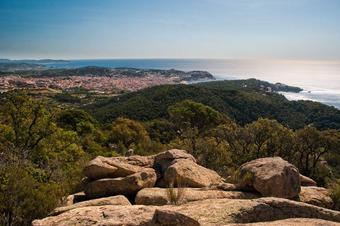
We pass by the abandoned Can Miralls farmhouse where we find a spectacular stone pine. We start to walk around the Pico de Can Toni and before reaching the Portes hill, we enter a pretty cork oak grove with small trees that grow in fine soil amongst granite boulders.
In front of us, the d'Cirera coast, where we will now go up in the direction of the Pico Gros antennas. We already start to see the first stone castles.
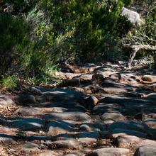
After the Portes and the Pla de Ses Mòdeques, in a paved section of the path, we find a sign that tells us we are on a Roman path. Now a section starts that goes to the top of the Pico Gros, difficult and complicated to walk up, where we will have to take great care.
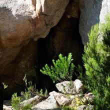
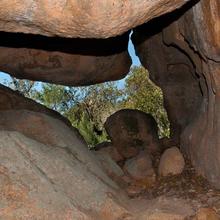
We pass underneath cork oaks and heather; through clearings with juniper, rock-rose and rosemary bushes. We find the odd window that allows us to see through to the Mediterranean and the village of Sant Feliu de Guíxols. During the ascent, we find some of the itinerary's rock formations: the d'en Cirera cave, the Águila cave and the Àguila stone.
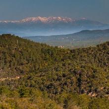
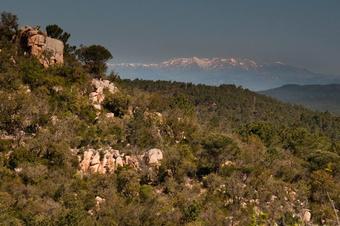
Coming down from the Pico Gros, we enjoy fantastic views of the Canigó massif, skirting the Ullada Stone. We reach the Mare de Déu hill and from here, if we want and if we have any energy left, we can climb up to Pico Romaguer (or Pico del Águila) in around ten minutes.
We will come down following the Les Mànegues stream (a tributary of the Les Comes stream)
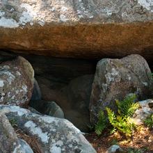
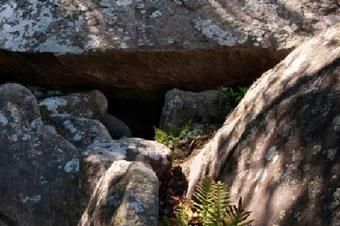
It's worth taking a closer look at the Tres Fonts fountain, (there's normally no water flowing), as it's also interesting to see some of the caves, tombs from the megalithic past and the Can Assols cave.
After descending for some time, first along pretty, dense paths and then along a track between cork oaks, we again reach the Les Comes stream. In this case, the vegetation of the riverbank (hazelnut trees, ash trees and oaks) forms a contrast with the dry forests that have accompanied us along the top part of the mountain range.
Tips
TRAÇAT
- A causa dels molts elements rocosos a visitar, el temps total serà molt superior al normal.
- No seguiu cap dels diferents senyals que anem trobant pel camí.
- Combinem camí forestal amb viaranys o corriols de mal caminar. Tant de pujada com de baixada.
- El tram que va del POi del Camí Romà fins dalt el Puig Gros, requereix habilitat en seguiment de fites, ja que el GPS perd precisió i només serveix per verificar la direcció que portem. Difícilment us marcarà la posició just sobre la línia del track. En aquest moment, heu de seguir les fites (piles) de pedres i marques de color blanc. Hi ha fortes pujades i baixades però són curtes.
- Si a Coll de Portes no us trobeu bé, podeu tornar a Sant Feliu direcció la Riera de les Comes. Si no, a sota mateix, teniu la carretera on us poden venir a buscar.
AIGUA
- Les fonts que trobem normalment no ragen.
- Porteu aigua suficient.
PRECAUCIONS
- Heu d’estar habituats a caminar per muntanya. Valoreu el vostre estat físic.
- Si us desorienteu, torneu al últim punt conegut.
- Als trams de corriols, no us capfiqueu en anar sobre la línia del track. Només verifiqueu la direcció.
- Precaució en enfilar-se als elements rocosos. Algunes pedres, no tenen una estabilitat total (penseu que la pedra cavallera de Pedralta va caure).
- Vigileu els més petits quan arribeu a un castell de pedres.
- Respecteu aquests elements i el seu entorn. Compleixen una funció pedagògica i tenen valor paisatgístic, geològic i botànic. Alhora, alguns són patrimoni cultural megalític.
METEO
- Assegureu un dia estable.
- El recorregut és prou llarg perquè hi hagi canvi de temps.
- A les parts altes del Puig Gros bufa fort vent.
- Si ho feu havent plogut, quedareu xops igual perquè la vegetació us mullarà.
TERRENY
- És fàcil de relliscar pel sauló o patir tortes de peu als corriols pedregosos.
- Si ha plogut, aneu molt amb compte amb les relliscades. (roques i arrels)
MATERIAL
- Calçat còmode i resistent. Millor si té sola adherent.
- Aigua suficient i alguna cosa per anar menjant. Podeu fer un àpat més complet a la font dels tres raigs.
- Un mapa de la zona per ubicar-vos millor.
- Màquina de fer fotos.
ALTRES EQUIPAMENTS
- Si us documenteu, segur que poden trobar altres elements granítics per visitar, propers a l’itinerari.
- Del Coll de la Mare de Déu podeu pujar en 15’ al mirador del Puig de l’Àliga o Romaguer.
- Passareu prop d’un Parc d’Aventura, (Coll de Portes)
- A la font dels 3 raigs hi ha una taula per seure a l’ombra.
- Els trams de camí romà, estan senyalitzats.






Hem fet la ruta avui amb una amiga i el meu gos i ens ha encantat. A la part de les pedres ens hem trobat al mig de la vegetació sense pista i ens ha costat una mica, però també ha estat molt divertit. L'aconsellem només a gent a qui li agradi l'aventura, en bona forma física i sense por de perdre's. I d'anar-hi amb sabates bones perquè sí la baixada rellisca. Repetirem!