Return

Salt de Sallent pel mirador dels Bassis

Route
08/08/2013
Index card

Introduction

Landscapes, Romanesque and Geology

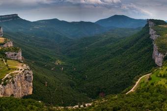
This path from Rupit to Salt de Sallent is an alternative proposal for descent and climbing along the classic path of the stream. We can enjoy the spectacular views of all the sun decks and eastern cliffs of “Collsacabra” to the cliff of the Lighthouse, over the “Susqueda” water reservoir. A visit to the Romanesque well represented by “St. Joan de Fàbregues” to the south of Rupit until reaching “Salt de Sallent”. Going back through the Rupit stream, discovering the vegetation and looking at the footprints of the “Molí del Rodor” and its cliff.

We recommend the Local Natura App to do this route. Download it for free here:

Apple store Google Play

  • Typology
    Anti-clockwise circular
  • Difficulty
    Easy
  • Duration
    2 hours 10 minutes
  • Slope
    290.00 meters
  • Distance
    6.50 km
  • Theme
    Flora and fauna
    Landscaping
    Geologia
  • Activity
    By foot
  • Rating

Slope graph

Description

Landscapes, Romanesque and Geology

We leave the Rupit road to “St. Joan de Fàbregues” we have views of the wooden hanging bridge over the Rupit stream. We turn off at the hill and church of “Sta. Magdalena”. The views over the town and the “Agullola” cliff are worth it.

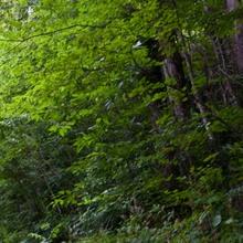
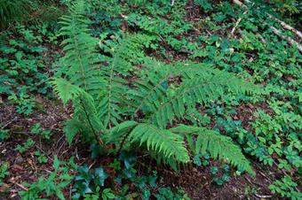
Now we go down the stream and we follow it down on the right-hand side, without seeing the water, in a shady oak grove and below the hazel trees, booms, polypods and ivy on the ground. We hear the rumor of the water in the jumps of the “Rodor” mill that we will later see.

We go up to the track and back to take a less frequented one that will climb up the “Palomera”. A whole wet forest of lime trees, ash trees, some chestnut trees, and hazel trees accompany us along a pleasant cobbled path.

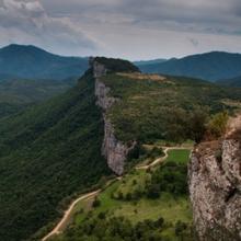
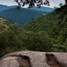
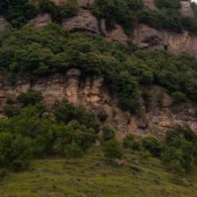
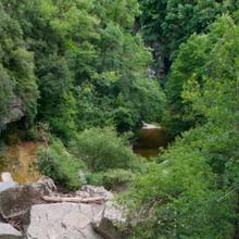
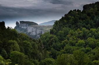
Spectacular views over the “Bassis” plain viewpoint. All the cliff from “Agullola” to the Lighthouse and the oblique slopes of the “Guilleries” in front.

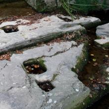
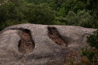
We descend by the right-hand side passing by the side of anthropomorphous tombs. Notice how the vegetation has changed completely. Now facing the sun, the dominant forest is a mountain of holm oak used to make coal in the past. The descent way is beautiful.

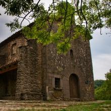
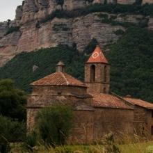
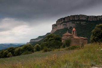
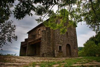
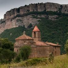
It's worth going to “St.Joan de Fàbregues”. Fantastic example of Romanesque art. There are tables and benches.

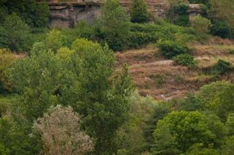
We take the direction towards the “Salt de Sallent” and we can see the vegetation of the sun decks of the cliff dominated by the holm oak, accompanied by black maples and dotted with oaks in the most humid corners.

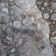
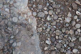
We cross Rupit’s stream and take the path to the “Salt de Sallent” viewpoint. Binoculars will help us discover the birds of these rocky environments. On the ground, we find many foram fossils type nummulit. Indicator of the former seabed, 55 million years ago in the eocene epoch of the tertiary era.

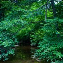
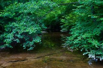
We go down again to the riverbed and before crossing it, we take the path that will take us upstream to the “Molí del Rodor” and its cliff. The riverside vegetation becomes present. Near and in the water the alders offer ‘postcard’ images, on the sides the large leaf ash trees, hazel trees, oaks and the bloodhound bush.

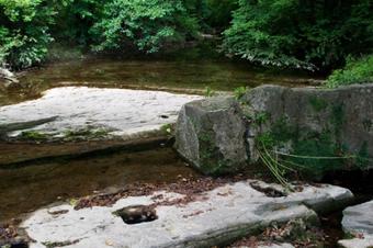
Next to the “La Pomadera” fountain, the old waterfalls such as “Sabaters” continue until reaching the cliff and “Moli del Rodor”. Here we find vestiges of this activity. (lock, holes, channel, ...) The place is nice and charming. Alders and hazels near the water make it a space for a quick rest and contemplation of the views. The road crosses the stream but we will continue the same way we came.

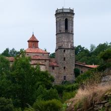
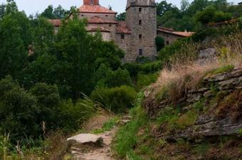
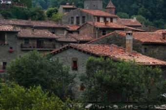
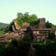
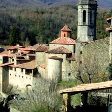
Soon we arrive to the village, crossing the “Saltiri” stream, we climbed a bit and we found the houses hanging on the stream. The village will rise on the fringes of the natural foundation of the cliff. The church of “Sant Miquel” stands out.

Tips

Track

  • A considerable and easy climb to Pla dels Bassis.
  • Descents with stone stairs, fun, from “Pla dels Bassis”.
  • The itinerary can be simplified by going to “Salt de Sallent” and returning to “Riera de Rupit”. You will shorten the route about 1 hour, but you will lose some wonderful points of interest.

Water

  • There is only one fountain returning through “Ria de Rupit”.
  • Precautions
  • Very careful with the youngest, on the edge of the cliffs.
  • You must pay attention to get off “Mirador dels Bassis”.
  • Cliffs are places exposed to the wind. On cold and windy days, take protection.

Land

  • Easy in general.
  • Downhill route from the “Bassis” viewpoint, more technical.
  • Comfortable mountain footwear.

Material

  • Binoculars to see birds in the cliffs.
  • Camera for landscapes and architectural heritage.

Save the route

What is there

What to see in: Salt de Sallent pel mirador dels Bassis

Es mostren 1 - 11 de 11

Santa Magdalena

Point of interest
Architecture
08/08/2013

We are on top of a mound formed by a meander of the stream. Looking down, we can see the “Agullola” cliff.

The chapel of “Santa Magdalena de Rupit”, baroque and built in the 17th century, stands out...

Bosc caducifoli

Point of interest
Flora
08/08/2013

The oblique orientation and the influence of the stream, makes the conditions favorable to this forest made up of oak, broad leaf ash trees, lime trees, hazel trees and more sporadically chestnut...

Mirador dels Bassis

Point of interest
Landscapes
08/08/2013

We have climbed to the top of “La Palomera” and we are on the “Bassis” viewpoint. In front of us, the entire slope of the “Guilleries” (Pre-coastal Serralada). Below, the valley of Rupit’s stream and...

Tombes

Point of interest
Others
08/08/2013

It is possible that they were made by people who knew what they wanted but did not know how to do it" and concludes: "In summary, people migrated from the plains of the south, men and women who...

Sant Joan de Fàbregues

Point of interest
Architecture
08/08/2013

Romanesque building, the current structure dates to the 11th century. During the earthquake of year 1427 it was very damaged. The church of Rupit had been under jurisdiction of the parish of Sant Joan...

Alzinar

Point of interest
Flora
08/08/2013

Going down from the “Bassis” we crossed a mountainous oak forest clearly exposed to the south. We usually find it at lower levels, below the cliffs. Probably taken advantage of for wood for heating...

Mirador del Salt

Point of interest
Geology
08/08/2013

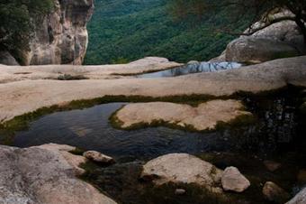
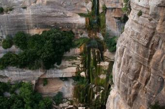
The Rupit stream, after meanders, retakes and small jumps used long ago, arrives to the margin of the cliff where it is freed from the “Collsacabra”, in the form of an impressive 80-meter high jump.

T...

Vegetació de ribera

Point of interest
Flora
08/08/2013

This shady path passes through the left bank of Rupit’s stream. On the other side of the water, the leaves and a bit more separated are broad leaf ash trees, hazel trees, oaks and other trees, such as...

Font Pomadera

Point of interest
Others
08/08/2013

A long time ago, it was a must-see point for the people who came down from the village where the quality and freshness of the water that irrigated throughout the year was appreciated. Fresh atmosphere...

Molins fariners

Point of interest
Environment
08/08/2013

Present from the 10th century, it is worth noting how the gap in the stream had been used until recently, in this last stretch of few kilometers until reaching the edge of the cliff. A whole series of...

Sant Miquel

Point of interest
Architecture
08/08/2013

Baroque building with neoclassical elements in the form of a Latin cross, with side chapels and the cruise finished with the dome, arose as a subsidiary of the church of St. Joan de Fàbregues (until...

Images
Rating
/5
19 votes
82%
Ratings with comments Publish rating

Una ruta molt agradable i amb un paisatge fantàstic. Si es va amb nens, es pot fer anada i tornada al Salt de Sallent pel mateix recorregut ja que no es gairé llarg (uns 40 min per recorregut) ni complicat.

Bones recomanacions per una gran sortida des de Rupit

Muy buena ruta, fácil e interesante para ir toda la familia. Accesible y no muy pronunciada.

Molt maca aquesta ruta ,amb les meves filles de 4anys i 2 anys

I've been loniokg for a post like this for an age

Hemos hecho esta ruta y es ESPECTACULAR...pero la hicimos en sentido contrario y acabamos n la ermita de Sta Magdalena con una vistas preciosas de Rupit. La recomiendo hacer en sentido contrario al sugerido

ha sigut genial, recurregut fácil i entretingut. el salt espectacular. totalment recomanable!

Bona ruta circular per fer en familia. El camí està ben senyalitzat i hi ha molt bones vistes. Es poden fer variants també senyalitzades. Si es va amb gent que no pugui caminar massa, des del parquing del Salt de Sallent hi ha un camí planer i curt fins el salt. Recomano, si es pot, no fer-la en festius molt assenyalats per evitar aglomeracions.
La ruta sobre todo al principio no está bien señalizada, hay varias bifurcaciones y no sabes por donde ir. Cuando lleges al símbolo de exclamación que pone pista gira a la derecha antes del Mirador dels Bassis sigue la carretera unos metros y a mano izquierda hay un sendero, ves fijandote bien si no te pasarás de largo, aunque hay un símbolo X rojo y blanco en un arbol, sigue por ahi, el sendero esta lleno de maleza pero se puede pasar
Profile picture for user juanjo -natura-
Juanjo -natura-
11/02/2020

In reply to by atrapao640@gmail.com

Hola. No olvideis seguir la ruta con la App de Natura Local. Las marcas no siempre tienen porque coincidir con nuestra propuesta. Si siguiendo la ruta te alejas del track, la app tiene alarmas para indicarte que te estas separando. Bueno, suerte la próxima vez.
Hoy hemos echo esta ruta, es muy bonito todo, pero para subir al mirador den bassi el camino estaba intransitable a causa de los árboles caídos en la última tormenta, hay que salir del camino para poder subir. A partir del mirador hasta rupit, perfecto.
ruta confusa i en desús, no es pot seguir a partir de cert punt.
Ruta mal senyalitzada wn alguns trams, l'accés al mirador d'en Bassis no està senyalitzat i és plè de branques que el fan inaccessible. No hi vam poder arribar. L'app funciona correctament i t'avisa quan et surts de l'itinerari. El tram de retorn cap a Rupit tot correcte.
The route is NOT doable! It is an old route that has now been invaded by the nature... we had to turn back!
És una ruta dificil...el cami marcat a la app no està gens nitit quan t'adritres bosc ja qué no n'hi ha Camí, està ple de vegetació salvatge que has d'anar esquivan, ple d'arbres caiguts i cap senyalització fins arribar a les tombes antropomorfiques. Et pots perdre fácilment. Despres de passar aquest tram (trigaràs una 30 minuts si mes o menys et saps moure pel bosc i entens el mapa) el Camí és nitit i senyalitzat.
Visits

What to see in: Salt de Sallent pel mirador dels Bassis

Es mostren 1 - 5 de 5
  • Filter by type
    Theme
Services

What to do in: Salt de Sallent pel mirador dels Bassis

Es mostren 1 - 10 de 29
  • Filter by type
    Theme