Introduction
The visual power of the massif.
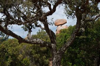
This route to the Pico de les Cols (409m) from Sant Feliu de Guixols allows us to access the highest parts of this gentle relief that characterises the Ardenya-Cadiretes massif. We will enjoy fantastic 360º panoramic views and discover some of the sculpted granite structures, such as the Pedralta block, passing through cork oak woods damaged by fire.
We recommend the Local Natura App to do this route. Download it for free here:
Apple store Google Play

-
TypologyAnti-clockwise circular
-
DifficultyMedian
-
Duration2 hours 30 minutes
-
Slope320.00 meters
-
Distance7.90 km
-
ThemeFlora and faunaEnvironmentLandscaping
-
ActivityBy foot
-
Rating
Slope graph

Description
The visual power of the massif.
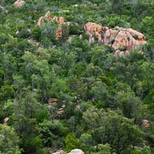
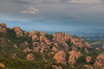
The Ardenya-Cadiretes massif is characterised by its gentle slopes, mostly covered in cork oak forests with scattered granite outcrops, some of which have unique shapes like the Pedralta block.
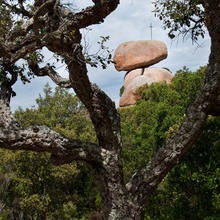
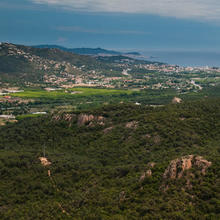
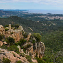
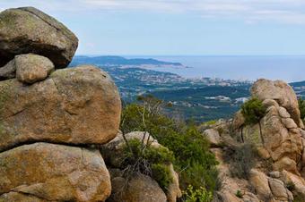
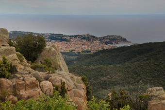
We leave the "3 ways" after the Casa Nova urbanisation, following the contour of the Pico d'en Jofre along a pretty path until we find the main paved road that goes up to the Pedralta plain. Stone pines, maritime pines and cork oaks hide the views. We will have to wait until we reach the Pedralta Chapel to climb to the top of the Lookout Point. Once there, we have the first views of the coast from Sant Feliu to Palamós, of the Les Gavarres massif with Santa Cristina d'Aro just below and the Girona and Selvatana plains. Views that open up as we turn to the north-east.
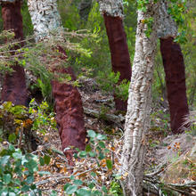
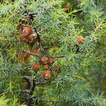
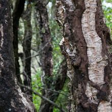
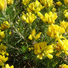
After staying close to the chapel and enjoying the uniqueness of the Pedralta block (which used to rock to and fro), we set off in a southwesterly direction towards the Pico de les Cols without losing altitude. Before this we will go up and down some steep slopes, surrounded by small holm oaks the bark of which has been burnt by fire. Heather, strawberry trees and junipers are the dominant shrubs that block our way along the path towards the narrower paths. In the clearings, rosemary, rock-rose and everlast (where the soil is finer), add a hint of colour.
The slope up to the Pico de les Cols (409m) is pretty and interesting. You need to use your hands to get up some of the stone steps. Once at the summit, the 360º views are spectacular. The coastal mountain ranges of El Montseny and Les Guilleries, the cross-wise structure with the Collsacabra and the Finestres and Rocacorba mountain ranges, the Montnegre, Les Gavarres, the plains of the pre-coastal depression, the Eastern Pyrenees with the Canigó standing out. All together, a field lesson in geography.
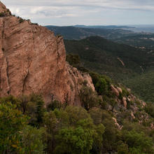
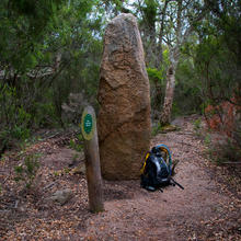
Further down, down a steep slope between blocks of pink granite, we find a few landmarks. You need to pay attention to avoid losing the path or tripping up. We reach the l'Escorp hill, where it's worth taking a closer look at the Terme Gros menhir. A bit further down we get to La Creu and the d'en Barraquer hill.
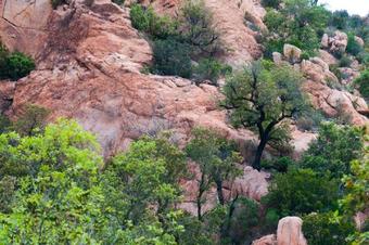
Now, on a gentle downwards slope with views of the Pico Gros, we get back to the starting point, once again surrounded by cleared forests of small cork oaks that have suffered the effects of fire. Close to the path, the blocks of pink granite have become detached from the upper parts, making a beautiful natural composition with the small holm oaks with black trunks.
Tips
TRAÇAT
- Anirem alternant trams de GR92 i trams de Punts Blaus.
- Hi ha un tram asfaltat, però majoritàriament camins i corriols. Són tècnics dalt la carena del Puig de les Cols.
- Trobarem dues dreceres per tornar abans d’arribar al Puig de les Cols. Una en el fondo del primer tram de línia elèctrica, i l’altre al Coll del Vidre. Els avisos us ho recordaran.
- Trobarem parts de pujada i baixada forta i amb pedra fluixa. També hi ha trams de pujada al Puig de les Cols on necessitarem les mans. (sense arribar a ser grimpada).
AIGUA
- Porteu aigua suficient.
- Les 2 fonts que trobem acostumen a estar seques.
PRECAUCIONS
- Vigileu els més joves a les parts altes del Puig de les Cols i del Mirador.
- Compte amb no relliscar a les baixades fortes amb sauló.
- Si ha plogut, la pedra també rellisca.
METEO
- Protecció pel vent i la pluja. A les parts altes dels puigs el vent és molest.
- És un itinerari incòmode per fer amb pluja o vent.
TERRENY
- Fàcil relliscar o patir una torta de peu.
- Trams amb pedra fluixa i amb sauló. Altres amb esglaons i petits blocs de pedra a superar.
- Als corriols s’ha de caminar amb atenció.
- Si està humit, les pedres rellisquen.
MATERIAL
- Calçat resistent i amb bona sola.
- Pals de tresc us poden ajudar a caminar i assegurar les baixades. A les pujades potser molesten.
- Porteu menjar per anar picant.
- Paravent per protegir-nos del vent o de la pluja.
- Un plànol de la zona ens servirà per situar nos dins el massís.
- Una màquina fotogràfica o de filmar, seran útils per enregistrar les vistes.
ALTRES EQUIPAMENTS
- De camí a l’inici de la ruta, passem pel davant de Sant Amanç.
- Trobareu algun plafó de situació general. També algun pal d’indicació de camins, indrets o elements com el Menhir del Terme Gros.







Las vistas preciosas. El entorno bastante salvaje.
No es una ruta fácil.
El tiempo que marca es un poco justo.
Nosotros a ritmo tranquilo tardamos 4h, pero apenas sin paradas