Introduction
The shade of Puig Alt (492 m).
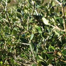
Short and pleasant route that allows us to discover, to see and to enjoy the harshness of the Cap de Creus landscape from its highest parts. We will pass through scrubland formed of rock roses and heather, through old terraced farmlands with some monumental cork oaks and passing by abandoned farms that are a reflection of a very different past.
We recommend the Local Natura App to do this route. Download it for free here:
Apple store Google Play-
TypologyTime Circular
-
DifficultyEasy
-
Duration1 hour 45 minutes
-
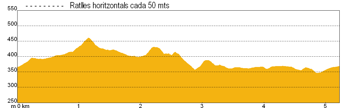
Slope164.00 meters
-
Distance5.60 km
-
ThemeFlora and faunaEnvironmentLandscaping
-
ActivityBy footBy bike
-
Rating
Slope graph
Description
The shade of Puig Alt (492 m).
We leave behind the El Pení military air base, along a wide track towards the shade of the Puig Alt mountain. The views are already wonderful, but get better and better.
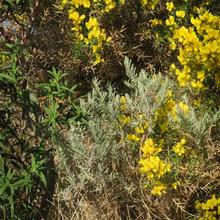
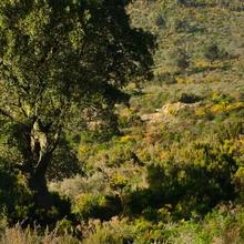
The vegetation we see at the beginning will predominate along the entire route. A scrubland dominated by rockroses, gorse and heather, firstly the result of the abandonment of agricultural land and then later damaged by fires and grazing.
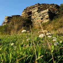
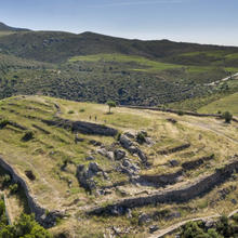
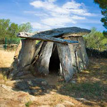
About 200 metres from the beginning there is another road to the left that leads down to a megalithic burial ground (700 m) where remains of cremation tombs of the Indo-European peoples of the 8th century BCE can be found.
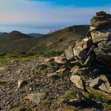
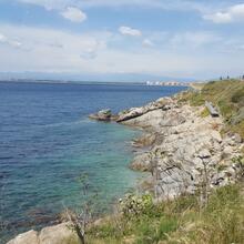
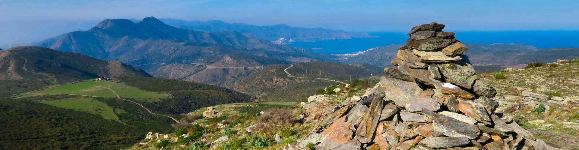
Returning to the initial path, this continues to Puig Alt, a spot with fantastic 360º views. Opposite this point is the Cap de Norfeu, a place classified as a natural reserve of the Cap de Creus Natural Park, and with a great wealth of flora and fauna, both on land and under the sea. We are at the head of the Vall de Montjoi and we should note the rugged, steep and also very different landscape of this area.
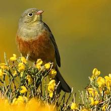
Above these ridges is a good place to observe the migration of birds, heading north in the spring and south in the autumn.
Behind us we see the interior of the Cap de Creus: the Serra de Rodes and the Serra de la Verdera, then down to the bay of Port de la Selva (Amunt sea); to the north the Pyrenees from Freser-Setcases to the Canigó and the Albera mountains that descend to the sea behind Llançà. Much closer, there are the farmhouses of the Arbres and Can Causà beneath the Puig de l'Àliga itself.
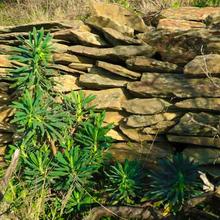
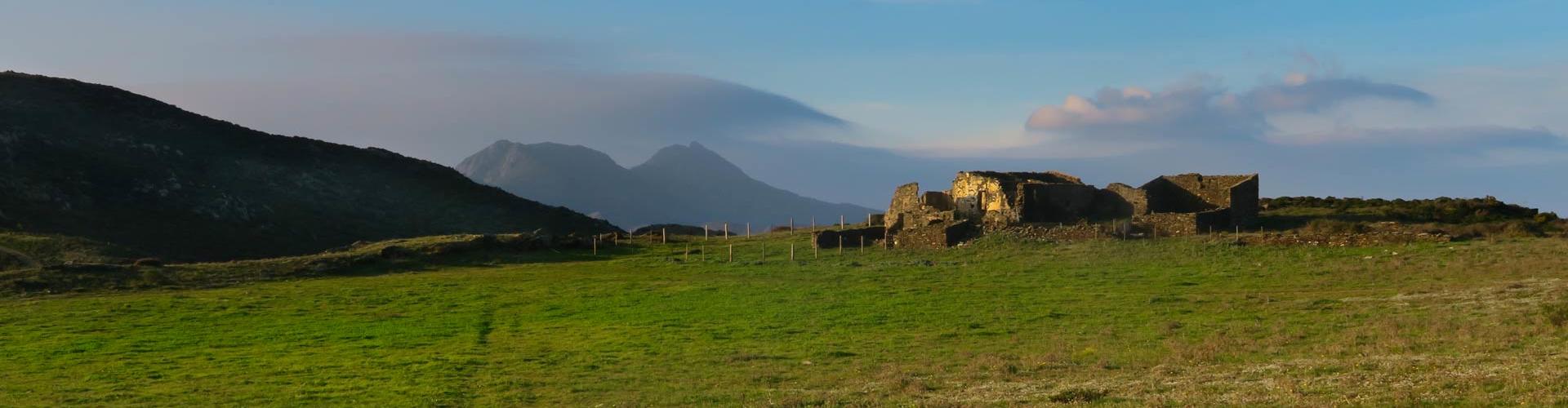
The itinerary continues along the path skirting the Puig Alt and the Puig Rodó mountains on the shady side, making a turn of almost 360 degrees to face the Puig de l'Àliga. To the left is the Empordà plain and the bay and village of Roses. We arrive at the Vich spring, where there is a watering hole for cattle and a water fountain (which is not in operation). The landscape is now much more agricultural. Despite being abandoned, vineyard huts and dry stone terraces lie scattered about, blurred by a carpet of aromatic and flowering plants (lavender, cistus and rock rose). After passing the spring, continuing along the route, the path arrives at a junction located on the Can Caussa plain, with the farm that gives name to this plateau in the background. From this point, we have a view opposite to that of the Bay of Roses: the north slope of the Cap de Creus, with the Amunt Sea below.
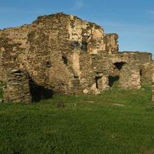
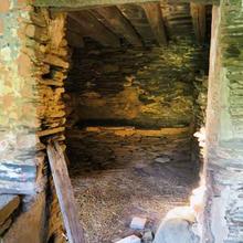
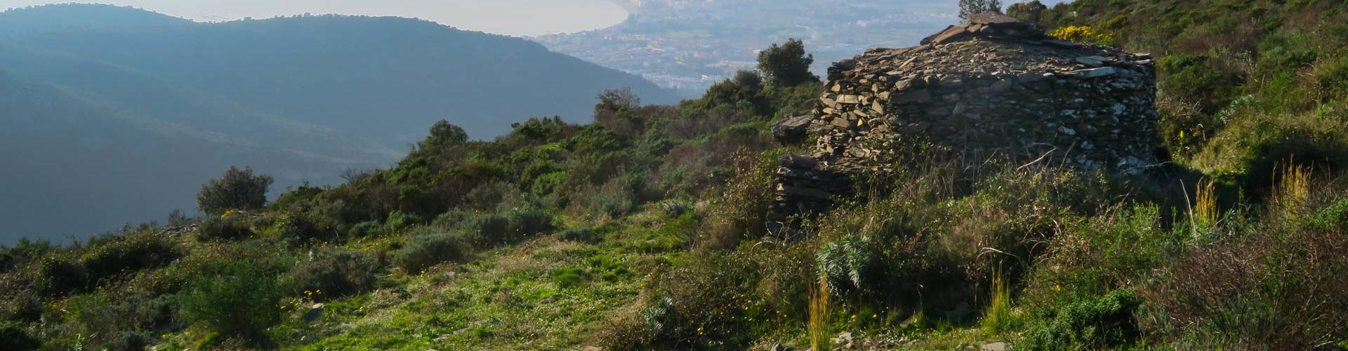
Further on, we arrive at a small hollow or ditch, formerly populated by numerous trees that gave their name to the construction that we find here: the Arbres farmhouse.
Finally, we return to the starting point of the route, where we left our vehicles, having made a tour that allowed us to enjoy views of the north and south of Cap de Creus with all its beautiful scenery.
Tips
ROUTE
- Easy walk along a track
- Do not follow any of the painted markings!
- We recommend climbing Puig Alt.
- The Points of Interest (POIs) near the burial mound cemetery are well worth a vist if you like the Megalithic period. The round trip is 1.4 km long.
- There is no shade.
- It is worth looking over the hills to see the other side of the ridge.
WATER
- There are no sources of drinking water
- There is no guarantee that the Vich spring will be flowing and the water is confined in a small cistern.
PRECAUTIONS
- Take care when descending Puig Alt.
- Be very careful if you approach the derelict farmhouses. Some walls could fall.
- There is a lot of gorse on the scrubland and its thorns can be difficult to remove.
WEATHER
- Avoid cold and windy days. The Tramuntana blows even stronger on the ridges.
- If there is mist or low clouds, the views will be impaired.
- In summer, be very careful in the sun. Wear sun protection and avoid the middle hours of the day. There is no shade.
EQUIPMENT
- Protective clothing against the wind.
- Sun protection on summer days: sunglasses, cap and sunscreen.
- Binoculars to see birds and the distant landscape.
- Camera for the landscape.
OTHER NOTES
- It shares the route and points of interest with the Megalithic of the Vall de Monjoi route. (R3)
- You will see the signposts at the interpretation points. You will need to have downloaded a QR reader application.