Introduction
Panoramic paths to the cliff
We propose a route where you can discover nature, landscapes and legends of the Tavertet plains. This time, to enjoy the informative content, we encourage you to play while answering the questions we have prepared for you along the route, clicking the "correct" button. You will also need to find and scan the QR codes that complement the proposal.
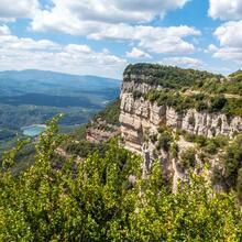
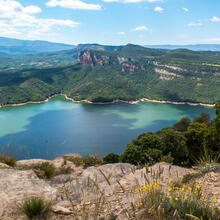
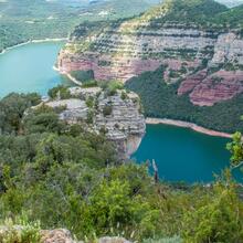
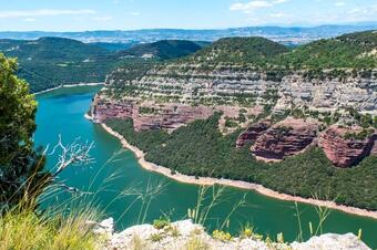
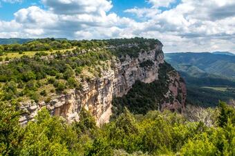
We are in front of one of the routes with the best panorama view over the Sau reservoir and the Balà corner. We will walk close to impressive cliffs with wide views of Osona, Montseny and Les Guilleries until we reach the final point of the route, the icing on the cake, Puig de la Força, where we will enjoy a 360º panoramic view and get to know the history of Cornil castle.
We recommend the Local Natura App to do this route. Download it for free here:
Apple store Google Play

-
TypologyLinear
-
DifficultyMedian
-
Duration2 hours 45 minutes
-
Slope485.00 meters
-
Distance6.70 km
-
ThemeFlora and faunaGeologiaLandscaping
-
ActivityBy foot
-
Rating
Slope graph

Description
Panoramic paths to the cliff
We propose a route where you can discover nature, landscapes and legends of the Tavertet plains. This time, to enjoy the informative content, we encourage you to play while answering the questions we have prepared for you along the route by clicking the "correct" button. You will also need to find and scan the QR codes that complement the proposal.
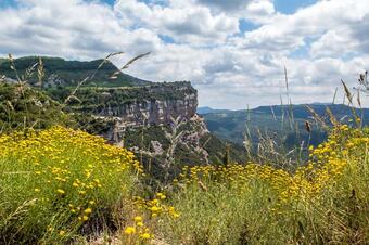
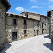
We start the route on the south-west side of the town, in the Relliguer area, and take the wide track that crosses over the cliffs, in the direction of the top of the Castle plain. The views of the cliffs, Montseny and Les Guilleries are spectacular.
The comfort of the trail will allow us, as we walk, to observe the landscape and learn something about the fauna and geology of this special place.
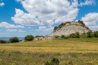
We always make our way flat or with a slight descent in the direction of the Castle, where we will approach the cliff and begin to have privileged views over the Sau swamp. It is from the area of Castle's path that the track stops being so comfortable to give way to a wide track with a lots of stones that will take us to the middle of the lower Castle plain, where we will leave this uncomfortable track to start descend steeply to the balm of the Castle.
The atmosphere from the balm is quite airy and although the path does not have great difficulties you have to be careful. Before reaching the Puig de la Força, we will cross a pass close to the remains of the Cornil castle and begin the final "attack" on the hill, from where the 360º views will take our breath away. Have extreme caution on this last stretch of the route.
Now we just have to go back to the starting point on the same path.
Tips
ROUTE
- We will be able to search and scan QR codes that will make our excursion more fun. At each point we will let you know if there is or not.
- Most of the route takes place on a wide and easy track. Towards the end of the route the track is stony.
- The path to the hill has some delicate sections:
the path down to Castle's balm is very steep. Follow the most obvious line and always stay close to the track.
to access the hill there is a delicate step with a rope tied to a sabina.
there are landmarks with stones and some faded red markings painted on the rock.
there are sections with stone steps.
WATER
- Fountains only in the village.
WARNINGS
- Avoid the central hours of the day especially in the summer.
- Watch out on the way down to the Balm of the Castle.
- Have extreme caution on sections near the cliff.
- To access the hill there is a delicate step. Be careful.
- Take the route off-line: the coverage below the balm is not very good.
WEATHER
- Avoid the central hours of the day especially in summer on the hottest days.
LAND
- Wide and well-marked tracks, except for the final section before the Puig de la Força.
- The descent to balm has a steep slope.
- At some point the path goes close over the cliff.
MATERIAL
- Sun protection on summer days.
- Binoculars if you like bird watching.
- Camera.


