Introduction
Here is a family-friendly, circular route that can be done either on foot or by bicycle, along paved agricultural paths leading to the basses de Can Dimoni. It is a pleasant walk that makes it easy to grasp the scale of the delta’s agricultural space, its landscape, its natural environment, and the farmhouses of the people who live and work here, helping to preserve this heritage.
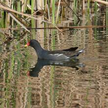
The basses de Can Dimoni are a unique site, among other reasons because they are the only natural area located right in the middle of the agricultural zone of the Llobregat delta.
We recommend the Local Natura App to do this route. Download it for free here:
Apple store Google Play-
TypologyAnti-clockwise circular
-
DifficultyFor families
-
Duration1 hour 50 minutes
-
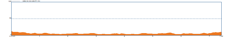
Slope40.00 meters
-
Distance7.40 km
-
ThemeFlora and faunaEnvironmentLandscaping
-
ActivityBy footBy bike
-
Rating
Slope graph
Description
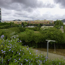
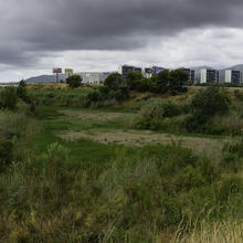
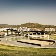
We start the route in the parc de la Marina, taking the avenida de la Tecnologia eastwards (towards Sant Boi de Llobregat) until reaching the roundabout with carrer de Catalunya. Here we turn off and pass under the C-32, following the signs towards the Espai natural de les basses de Can Dimoni.
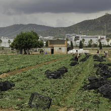
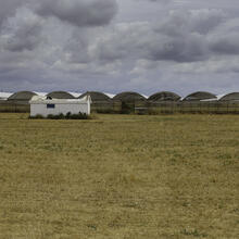
We enter the Parc Agrari del Baix Llobregat. Before the railway bridge, next to the bassa de laminació, we find a fork where we must turn left, leading us onto the camí de Ferran Puig. We follow the corredora that channels the water from the bassa de laminació to the Riera-roja. We cross the Riera-roja and, among cereal fields, vegetable plots, fig plantations and greenhouses, we reach the junction with the camí de Cal Francès, which we follow by turning right.
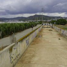
We continue to the fork with the camí de Cristòfol Rebull, which we leave on our left to stay on the camí de Cal Francès, climbing the bridge (also a viewpoint) to the right, over the railway line. After descending the bridge, we continue straight along the same camí de Cal Francès until reaching a right-hand turn that leads us to the entrance of the Espai natural de les basses de Can Dimoni, on the right-hand side of the path, next to some sheep pens.
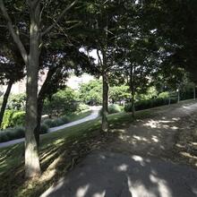
Once at the basses, it is possible to follow the linear path along the edge of the bassa gran to some floodable meadows and a small grove of tamarisks. We reach a point where access is barred, as these are very fragile areas. Therefore, it is not possible to reach the bassa petita or to access the nearby farmhouses (see track).
On the way back, when we reach the railway bridge, we do not climb it again, but instead turn left along the camí del ferrocarril towards Can Ràfoles. Upon reaching the Les Tanques riding school, along the path of the same name, we then do climb the railway bridge and, with views over the town and the Ordal-Garraf mountain ranges behind it, we return to the starting point.
Tips
ROUTE
Flat route with no technical difficulty, along paved roads.
The outward route is signposted.
The return route follows the path alongside Can Ràfoles.
There are two gentle rises to cross the railway bridge.
You must decide whether to walk around the bassa gran or remain at the observation point near the entrance. In spring and summer, access to other areas is usually restricted.
WATER
Bring water from home.
PRECAUTIONS
These are agricultural paths used by vans and tractors. Take care.
Respect private property: agricultural land.
Give priority to agricultural vehicles.
Do not use headphones, so you remain alert to the presence of machinery.
Always keep to the marked paths.
Respect the natural environment, both at the basses and along the route.
Watch children carefully near the corredoras or drainage channels.
Do not litter. Take your rubbish home or dispose of it in a container.
Preserve the landscape and its ecological value by respecting flora and fauna.
WEATHER
Avoid the central hours of summer days. There is little shade.
Windy days can be very uncomfortable.
EQUIPMENT
Binoculars for birdwatching at the basses.
A bird identification guide will be very useful for recognising different species.
Sun protection in summer.
Mosquito repellent.
If you do the route by bicycle, wear protective equipment such as a helmet, reflective elements and puncture repair tools.
OTHER FACILITIES
Open permanently.
Check visiting hours (here).
Interpretive panels of the Parc Agrari and the basses.
Picnic tables at the basses.
Rest areas along the camí del Mar.