Introduction
We propose an itinerary that can be done on foot in a counterclockwise direction; by bicycle, we recommend doing it clockwise. It is a short route, but with a steep and sudden elevation gain right at the beginning, until reaching the top of the Josep Lligades viewpoint.
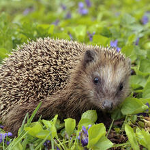
It runs through the Parc forestal del Mas Ratés as far as the torrent de Can Trius, allowing you to discover nature in the serra de Miramar between the Roureda and the Puig de Miramar.
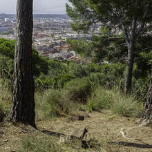
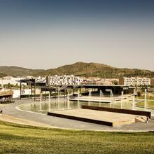
You will enjoy the natural surroundings close to Viladecans, as well as views of the serra del Montbaig, the ermita de Sant Ramon, and the entire plain of the delta del Llobregat.
We recommend the Local Natura App to do this route. Download it for free here:
Apple store Google Play-
TypologyAnti-clockwise circular
-
DifficultyMedian
-
Duration1 hour 15 minutes
-
Slope157.00 meters
-
Distance2.50 km
-
ThemeFlora and faunaLandscaping
-
ActivityBy footBy bike
-
Rating
Slope graph

Description
From carrer de l’Arboç in Viladecans, next to the Casa de les Abelles, we begin our itinerary heading towards the Mirador Josep Lligades along the forest track, always uphill and heading north.
Once at the top, we will enjoy wide views of the ermita de Sant Ramon and Viladecans. We continue the route with a gentle descent along the track, between large broom shrubs and tree heathers, until the first junction on the left, which takes us downhill again towards the town.
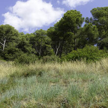
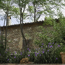
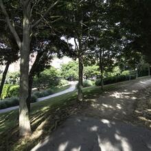
We pass by carob trees and stone terraces that speak of the agricultural past of the mountain range, and soon enter the pine forest of the lower part of the range, reaching the Jardí de les Papallones and the Bassa dels Amfibis. A beautiful spot to sit and rest for a while.
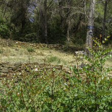
We continue behind the houses on carrer de Salamanca to the head of the torrent de Can Trius. The clearing of the power line corridor creates open grassland clearings and open spaces with many insects. At the same time, many dry-stone walls remain clearly visible.
We cross a beautiful pine forest with large lentisks and aladierns, dotted with the occasional carob tree, until almost below plaça del Romaní. From here we descend to cross the torrent and head towards the mas de Can Pere Trius.
All that remains now is to follow the track through the street network, passing by the site where the mas de Can Ratés once stood, and returning to the starting point at the Parc del Mas Ratés.
Tips
ROUTE
We suggest doing the itinerary on foot in whichever direction you prefer, preferably counterclockwise. By bicycle, it is better to do it clockwise to match street sections with traffic direction and to avoid the steep climb to the viewpoint.
Section with a steep ascent and later a steep descent towards the Josep Lligades viewpoint.
WATER
There is a fountain in the park.
PRECAUTIONS
If you do the route by MTB in a clockwise direction, the descent is delicate.
On foot, the first climb is steep.
Respect the natural environment and private property.
WEATHER
On cloudy or foggy days, you will not be able to enjoy the views.
Be careful during the central hours of hot days. There is no shade on the climb.
TERRAIN
Wide track and paths in good condition.
On the uphill track to the viewpoint there may be loose stones.
EQUIPMENT
Binoculars to enjoy the views.
Trekking poles can be helpful.
Basic safety equipment (helmet and gloves) and puncture repair tools if you are doing the route by MTB.
OTHER FACILITIES
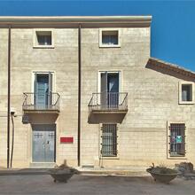
The Casa de les Abelles. A facility with educational purposes related to these insects and their relationship with the ecosystem, honey production, and much more. Workshops and visits to the Mas Ratés beehive are held here.
Interpretive panels about the Parc Forestal de Mas Ratés at various points.
Picnic tables around the Casa de les Abelles, at the start of the route.
There are proposed micro-itineraries with interpretive panels on ecology and nature: Ruta del mirador, Ruta de les papallones and Ruta de la biodiversitat, which start from different streets. Don’t worry, the current track is a combination of all three.